

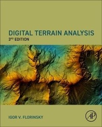
Digital Terrain Analysis, Third Edition
3. Auflage
Erschienen am 27. Januar 2025
Buch
Hardcover
476 Seiten
978-0-443-24798-9 (ISBN)
Beschreibung
Digital Terrain Analysis, Third Edition synthesizes knowledge on methods and applications of digital terrain analysis and geomorphometry in the context of multi-scale problems in soil science, geology, and polar research. Divided into four parts, the book examines the main concepts, principles, and methods of digital terrain modeling, methods for analysis, modeling, and mapping of spatial distribution of soil properties, techniques for recognition, analysis, and interpretation of topographically manifested geological features, and finally, polar research. This new release provides a theoretical and methodological basis for understanding and applying geographical modeling techniques.
Weitere Details
Auflage
3rd edition
Sprache
Englisch
Verlagsort
San Diego
USA
Verlagsgruppe
Elsevier Science Publishing Co Inc
Zielgruppe
Für Beruf und Forschung
Produkt-Hinweis
Fadenheftung
Gewebe-Einband
Maße
Höhe: 284 mm
Breite: 223 mm
Dicke: 28 mm
Gewicht
1529 gr
ISBN-13
978-0-443-24798-9 (9780443247989)
Copyright in bibliographic data and cover images is held by Nielsen Book Services Limited or by the publishers or by their respective licensors: all rights reserved.
Schweitzer Klassifikation
Weitere Ausgaben
Andere Ausgaben
Igor Florinsky
Digital Terrain Analysis, Third Edition
E-Book
01/2025
3. Auflage
Academic Press
148,99 €
Als Download verfügbar
Vorauflage
Igor Florinsky
Digital Terrain Analysis in Soil Science and Geology
Buch
07/2016
2. Auflage
Academic Press
160,87 €
Versand in 15-20 Tagen
Person
Igor Florinsky is a Principal Research Scientist at the Keldysh Institute of Applied Mathematics, Russian Academy of Sciences. He has previously held positions as a Visiting Fellow at the Agriculture and Agri-Food Canada and a Research Scientist at the University of Manitoba in Canada. He is an author, co-author, or editor of over 125 publications including 2 books, 2 edited volumes, 50 papers in peer-reviewed journals, and 13 peer-reviewed book chapters. He is an Editorial Board Member for the journals Chinese Geographical Science, Space and Time, and the International Journal of Ecology and Development. His research interests include digital terrain modeling and geomorphometry, interrelationships between topography, soils, and tectonics, and the influence of the geological environment on humans, society and civilization.
Inhalt
1. Digital terrain analysis: past and present
Part I: Principles and Methods of Digital Terrain Modeling
2. Topographic surface and its characterization
3. Digital elevation models
4. Calculation methods
5. Errors and accuracy
6. Filtering
7. Universal spectral analytical modeling
8. Mapping and visualization
Part II: Digital Terrain Modeling in Soil Science
9. Influence of topography on soil properties
10. Adequate resolution of models
11. Predictive soil mapping
12. Analyzing relationships in the topography-soil system
Part III: Digital Terrain Modeling in Geology
13. Folds and folding
14. Lineaments and faults
15. Accumulation zones and fault intersections
16. Global topography and tectonic structures
Part IV: Digital Terrain Modeling in Glaciology and Polar Research
17. Glacier motion and evolution
18. Crevasses
19. Catastrophic glacier events
20. Antarctic oases
21. Concluding remarks and pending problems
Part I: Principles and Methods of Digital Terrain Modeling
2. Topographic surface and its characterization
3. Digital elevation models
4. Calculation methods
5. Errors and accuracy
6. Filtering
7. Universal spectral analytical modeling
8. Mapping and visualization
Part II: Digital Terrain Modeling in Soil Science
9. Influence of topography on soil properties
10. Adequate resolution of models
11. Predictive soil mapping
12. Analyzing relationships in the topography-soil system
Part III: Digital Terrain Modeling in Geology
13. Folds and folding
14. Lineaments and faults
15. Accumulation zones and fault intersections
16. Global topography and tectonic structures
Part IV: Digital Terrain Modeling in Glaciology and Polar Research
17. Glacier motion and evolution
18. Crevasses
19. Catastrophic glacier events
20. Antarctic oases
21. Concluding remarks and pending problems