

Xploreit Map of County Clare, Ireland
Fountain Software and Publications Ltd (Publisher)
2nd Edition
Published on 1. February 2012
Other
Sheet map, folded
1 pages
978-0-9552655-4-9 (ISBN)
Description
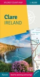
This new edition shows the new motorway network in Clare and Limerick. A handy map of Ennis Town centre has been added as well as many new walking and cycle trails. This popular map has a comprehensive set of tourist destinations including the Burren, the Aran Islands and the Cliffs of Moher. This detailed touring map provides a unique representation of County Clare - "The Banner County". There is information on antiquities, leisure spots, touring routes for motorists, cycling routes and walking trails. It covers famous destinations such as the Burren and the Cliffs of Moher but also includes many lesser known spots that are equally interesting and enjoyable. A comprehensive selection of golf courses, angling spots, beaches, historic sites, tourist centres and many other points of interest are clearly shown. The scale of the Clare map is 1:80,000. This title is waterproof and Rip-Proof. It includes a detailed Index. Tourist Attractions highlighted, as well as walks, cycle routes and scenic drives. This title includes Ennis Town Centre map showing pedestrian areas and park. It covers local mountains, rivers and lakes.
More details
Series
Edition
2nd Revised edition
Language
English
Place of publication
Ennis
Ireland
Edition type
Revised edition
Map scale
1:80000
Dimensions
Height: 254 mm
Width: 102 mm
ISBN-13
978-0-9552655-4-9 (9780955265549)
Copyright in bibliographic data and cover images is held by Nielsen Book Services Limited or by the publishers or by their respective licensors: all rights reserved.
Schweitzer Classification
Other editions
New editions
Other
06/2024
3rd Edition
Xploreit Maps
€21.50
Shipment within 3-4 weeks
Previous edition

M.B. Meagher
Xploreit Map of County Clare, Ireland
Other
05/2006
Xploreit Maps
€32.37
Article exhausted; check for reprint