

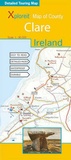
Xploreit Map of County Clare, Ireland
Published on 31. May 2006
Other
Sheet map, folded
978-0-9552655-0-1 (ISBN)
Description
This map provides a unique representation of County Clare - "The Banner County". It features world famous tourist destinations, and visitors can also discover the many other hidden beauty spots and heritage sites.Along with all of County Clare, parts of Counties Limerick, Kerry, Tipperary, Galway (including the famous Aran Islands) are shown on this map. World famous tourist destinations such as the Cliffs of Moher and the Burren are highlighted as are hundreds local beauty spots and heritage sites. All the local surfing spots are shown.The map is printed on a double-sided sheet and at a scale of 1:80 000 - it has therefore been possible to include a large area that is equivalent to approximately seven Ordnance Survey Discovery Maps. However the map is easy to read and is not cluttered with unnecessary detail."The County Clare" map fills a gap between the local Ordnance Survey 1:50,000 and the 1:250,000 scale maps. It is particularly suited to cyclists, but also includes the long distance way-marked walking ways and scenic drives along with all the local heritage and leisure points of interest.
More details
Series
Language
English
Place of publication
Ennis
Ireland
Publishing group
Fountain Software and Publications Ltd
Map scale
1:80000
Dimensions
Height: 250 mm
Width: 105 mm
ISBN-13
978-0-9552655-0-1 (9780955265501)
Copyright in bibliographic data is held by Nielsen Book Services Limited or its licensors: all rights reserved.
Schweitzer Classification
Other editions
New editions
Other
02/2012
2nd Edition
Fountain Software and Publications Ltd
€43.51
Article exhausted; check for reprint