

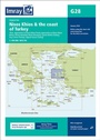
Imray Chart G28
Nisos Khios & the Coast of Turkey
Published on 1. December 2013
Other
Sheet map, folded
1 pages
978-1-84623-574-0 (ISBN)
Description
Plans included: Approaches to Psara (Nisos Psara) (1:15,000) Approaches to Khios (Nisos Khios) (1:20,000) Ormos Mandraki (Nisos Oinoussa) (1:8,000) Cesme Korfezi (Turkey) (1:18,000) Foca Limani (Turkey) (1:20,000) Sigacik Limani (Turkey) (1:18,000) On this 2013 edition full details of the new TSS schemes are shown at Izmir Korfezi, Candarli Korfezi and Nemrut Koyu; revised depths and harbour developments are shown at Psara, Khios, Cesme and Foca; the Sigacik Limani sketch plan has been replaced with a fully WGS84-compatible version; the latest known depths, restricted areas and marine farms have been applied to the main chart; and details of the recently deployed AIS transmitters are shown across the chart.
More details
Language
English
Place of publication
Huntingdon
United Kingdom
Dimensions
Height: 295 mm
Width: 210 mm
Thickness: 3 mm
ISBN-13
978-1-84623-574-0 (9781846235740)
Copyright in bibliographic data and cover images is held by Nielsen Book Services Limited or by the publishers or by their respective licensors: all rights reserved.
Schweitzer Classification
Other editions
New editions
Other
05/2018
Imray, Laurie, Norie & Wilson Ltd
€31.90
Shipment within 10-20 days
Previous edition

Other
06/2007
Imray, Laurie, Norie & Wilson Ltd
€39.84
Article exhausted; check for reprint