

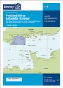
Imray Chart C5 2022
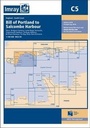
Portland Bill to Salcombe Harbour
Published on 9. May 2022
Other
Sheet map, folded
1 pages
978-1-78679-348-5 (ISBN)
Description
Plans included:
Bridport Harbour (1:5000)
Lyme Regis (1:10 000)
Exmouth (1:32 500)
Teignmouth Harbour (1:12 500)
Torquay Harbour (1:7700)
Brixham Harbour (1:7500)
Tor Bay (1:50 000)
River Dart Entrance (1:20 000)
This edition includes the latest official data combined with additional information sourced from Imray's network to make it ideal for small craft. The chart has been fully revised throughout.
More details
Series
Edition
New edition
Language
English
Place of publication
Huntingdon
United Kingdom
Edition type
New edition
ISBN-13
978-1-78679-348-5 (9781786793485)
Copyright in bibliographic data and cover images is held by Nielsen Book Services Limited or by the publishers or by their respective licensors: all rights reserved.
Schweitzer Classification
Other editions
New editions
Other
01/2023
Imray, Laurie, Norie & Wilson Ltd
€37.90
Shipment within 10-20 days
Previous edition
Book
10/2016
Imray, Laurie, Norie & Wilson Ltd
€44.70
Article exhausted; check for reprint
Person
Imray Laurie Norie & Wilson Ltd was formed in 1904 when three private chart publishing firms amalgamated. Each of these London companies had a long history going back to the mid-18th century. James Imray and Son published an extensive list of charts and pilot books. RH Laurie and Sons was associated with charts published for the East India Company. Norie and Wilson, founded by JW Norie, whose Nautical Tables are still supplied to navigators across the world, produced charts and books on navigation and sold nautical instruments.Until 1939 we were based in the City of London, where long serving cartographers produced charts from copper plate engravings which were supplied to mariners throughout the World. For over a century Blueback Charts were the first choice of many shipping companies. Now based in St Ives in Cambridgeshire, Imray charts are produced digitally for printed and electronic editions by our drawing office team. Our catalogue of yachting charts is regarded by the sailing community as the most comprehensive available. Our paper charts are complemented by a growing list of electronic publications and high quality pilot books by leading authors.