

Imray Chart B1
St Lucia
Published on 1. July 2013
Other
Sheet map, folded
1 pages
978-1-84623-552-8 (ISBN)
Description
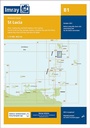
Plans included: Rodney Bay and Yacht Harbour (1:25,000) Port Castries (1:12,500) Grand Cul de Sac Bay (1:15,000) Marigot Harbour (1:7500) Soufriere Bay and The Pitons (1:40,000) Laborie Bay (1:20,000) Vieux Fort Bay and Anse de Sables (1:20,000) This 2013 edition shows harbour developments at Rodney Bay, Port Castries, Marigot Harbour and Vieux Fort Bay. The plan of Laborie Bay has been revised and details about moorings around Soufriere Bay and The Pitons marine reserve are now available.
More details
Language
English
Place of publication
Huntingdon
United Kingdom
Dimensions
Height: 295 mm
Width: 210 mm
Thickness: 3 mm
ISBN-13
978-1-84623-552-8 (9781846235528)
Copyright in bibliographic data and cover images is held by Nielsen Book Services Limited or by the publishers or by their respective licensors: all rights reserved.
Schweitzer Classification
Other editions
New editions
Other
10/2021
Imray, Laurie, Norie & Wilson Ltd
€31.90
Shipment within 10-20 days
Previous edition

Other
11/2006
Imray, Laurie, Norie & Wilson Ltd
€38.57
Article exhausted; check for reprint
Person
Imray Laurie Norie & Wilson Ltd was formed in 1904 when three private chart publishing firms amalgamated. Each of these London companies had a long history going back to the mid-18th century. James Imray and Son published an extensive list of charts and pilot books. RH Laurie and Sons was associated with charts published for the East India Company. Norie and Wilson, founded by JW Norie, whose Nautical Tables are still supplied to navigators across the world, produced charts and books on navigation and sold nautical instruments.Until 1939 we were based in the City of London, where long serving cartographers produced charts from copper plate engravings which were supplied to mariners throughout the World. For over a century Blueback Charts were the first choice of many shipping companies. Now based in St Ives in Cambridgeshire, Imray charts are produced digitally for printed and electronic editions by our drawing office team. Our catalogue of yachting charts is regarded by the sailing community as the most comprehensive available. Our paper charts are complemented by a growing list of electronic publications and high quality pilot books by leading authors.