

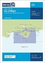
C3 Isle of Wight
Imray Chart
Published on 1. June 2026
Other
Sheet map
2 pages
978-1-78679-567-0 (ISBN)
Description
A passage planning chart ideal for sailing near or around the Isle of Wight. This chart has been reschemed to better complement the other folded charts in our Solent chart range (C15, Y33).
Coverage has been adjusted to show the full circumnavigation of the Isle of Wight including the south coast passage. Inset plans of the Needles Channel and Bembridge Harbour and approaches are included.
The latest official UKHO data is combined with additional information sourced from Imray's network to make it ideal for small craft. New: Vessel Traffic Services (VTS) reporting pointsImray charts for the Solent and approaches now include all VTS reporting points found in these waters. VTS reporting is mandatory for vessels of more than 20m in length that are bound to and from the Solent.
Plans included:
Needles Channel (1:35 000)
Bembridge Harbour and Approaches (1:10 000)
The chart is designed to be used alongside C15 The Solent for combined coastal navigation, approach, and harbour detail in and around the Solent and Isle of Wight.
More details
Edition
New edition
Language
English
Place of publication
Huntingdon
United Kingdom
Edition type
New edition
Dimensions
Height: 331 mm
Width: 236 mm
Thickness: 6 mm
Weight
184 gr
ISBN-13
978-1-78679-567-0 (9781786795670)
Copyright in bibliographic data and cover images is held by Nielsen Book Services Limited or by the publishers or by their respective licensors: all rights reserved.
Schweitzer Classification
Other editions
Previous edition
Other
03/2024
Imray, Laurie, Norie & Wilson Ltd
€37.90
Article exhausted; check for reprint
Person
Imray Laurie Norie & Wilson Ltd was formed in 1904 when three private chart publishing firms amalgamated. Each of these London companies had a long history going back to the mid-18th century. James Imray and Son published an extensive list of charts and pilot books. RH Laurie and Sons was associated with charts published for the East India Company. Norie and Wilson, founded by JW Norie, whose Nautical Tables are still supplied to navigators across the world, produced charts and books on navigation and sold nautical instruments.Until 1939 we were based in the City of London, where long serving cartographers produced charts from copper plate engravings which were supplied to mariners throughout the World. For over a century Blueback Charts were the first choice of many shipping companies. Now based in St Ives in Cambridgeshire, Imray charts are produced digitally for printed and electronic editions by our drawing office team. Our catalogue of yachting charts is regarded by the sailing community as the most comprehensive available. Our paper charts are complemented by a growing list of electronic publications and high quality pilot books by leading authors.