

Yorkshire Three Peaks Route Guide
Published on 1. March 2025
Other
Sheet map
2 pages
978-1-911321-10-1 (ISBN)
Description
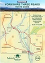
The Yorkshire Three Peaks Challenge - climbing Whernside, Ingleborough and Pen-yghent in a continuous circuit - is a tough challenge!
This handy route guide covers the full 24-mile circuit with detailed large-scale mapping at a scale of 1: 25,000, based on the latest OS maps but with superflous detail removed.
There are clear helpful directions on the map itself. The guide includes a route profile, along with mileage and suggested timings at each key point.
Also included are guide notes to circular walks for each individual peak from railway stations nearby - the best way to prepare for the Challenge and the best way to get the most
enjoyment from these humble but glorious mountains.
More details
Language
English
Place of publication
Shipley
United Kingdom
Illustrations
Colour mapping
Dimensions
Height: 420 mm
Width: 297 mm
Thickness: 1 mm
Weight
50 gr
ISBN-13
978-1-911321-10-1 (9781911321101)
Copyright in bibliographic data and cover images is held by Nielsen Book Services Limited or by the publishers or by their respective licensors: all rights reserved.
Schweitzer Classification
Other editions
Previous edition
Tony Grogan
Yorkshire Three Peaks Route Guide
Book
07/2019
2nd Edition
Skyware Ltd
€23.70
Shipment within 3-4 weeks