

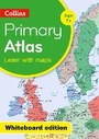
Collins Primary World Atlas Whiteboard Edition
Published on 14. February 2013
Software
CD-ROM
48 pages
978-0-00-748585-7 (ISBN)
Description
Collins Whiteboard Atlases make geography lessons more interesting and get the whole-class to participate. The 'big book' format enables you to work with all your students together, manipulating images and focusing on specific areas of study. The interactive format will help you and your pupils get the most from your atlas.
Collins Primary world Atlas presented on CD ROM for use on digital Whiteboards. 64 pages providing an introduction to mapping of the UK, Europe and major regions of the world.
Map skills section introduces map reading skills and a guide to using the atlas.
All reference maps are politically coloured clearly identifying country outlines. National flags of countries mapped on each spread are included.
Printable blank outline maps of the continents and the world are included to support classroom activities.
Key Features and Benefits of Collins Whiteboard Atlases:
Improves understanding of new concepts
Increases pupil motivation and involvement
Helps with the planning, pace and flow of lessons
More details
Series
Edition
New edition
Language
English
Place of publication
London
United Kingdom
Publishing group
HarperCollins Publishers
Target group
Primary & secondary/elementary & high school
Children/juvenile
Interest Age: From 7 to 11 years
Edition type
New edition
Dimensions
Height: 192 mm
Width: 135 mm
Thickness: 15 mm
Weight
80 gr
ISBN-13
978-0-00-748585-7 (9780007485857)
Copyright in bibliographic data and cover images is held by Nielsen Book Services Limited or by the publishers or by their respective licensors: all rights reserved.
Schweitzer Classification
Other editions
New editions
Collins Maps
Collins Primary Atlas - Whiteboard Edition
Software
02/2017
3rd Edition
Collins
€102.61
Article is exhausted; no reprint
Previous edition

Person
Explore the world through accurate and up-to-date mapping.