

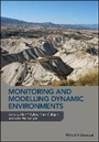
Monitoring and Modelling Dynamic Environments
Description
More details
Other editions
Additional editions
Persons
Content
CHAPTER 1
Introduction - Understanding and managing landscape change through multiple lenses: The case for integrative research in an era of global change
Alan P. Dykes1, Mark Mulligan2 and John Wainwright3
1 School of Civil Engineering and Construction, Kingston University, Kingston upon Thames, UK
2 Department of Geography, King's College London, London, UK
3 Department of Geography, Durham University, Durham, UK
The twenty-first century is when everything changes. And we must be ready.
(BBC 2006)
The world is changing. It has always been changing, as internal geophysical processes drive the tectonic systems that slowly rearrange the distributions of land masses and oceans and external influences such as orbital eccentricities alter the Earth's climate. Over hundreds of millions of years, the physical and ecological environments at any given location on land have been shaped and reshaped by natural then, from the late Pleistocene onwards, increasingly by human processes - so much so that some argue for a new geological epoch (the Anthropocene) in recognition of this (see Steffen et al. 2011; Brown et al. 2013). Our recognition of different kinds of impacts and implications of landscape changes has developed in parallel with the increasing rates of industrialisation of the last 250 years (Hooke 2000; Wilkinson 2005; Montgomery 2007). Humans are highly inventive in providing technological 'solutions' to feeding, watering and providing energy for ever-increasing populations, but this inventiveness does not always produce resilient or sustainable solutions. Indeed, it is often only when we are highly dependent upon these technologies that we begin to understand their negative effects on the environment that also sustains us. This is a reflection of both scientific advancement throughout the period and the increasing impacts on landscapes of the expanding industrial activities, including the industrialisation of agriculture, water and energy provision. However, although we know some of the impacts of these technologies on natural landscapes and the 'ecosystem services' that they provide, many aspects of the natural functioning of these landscapes remain uncertain.
The continually increasing population of the Earth has inevitably led to the expansion of anthropic modification of landscapes into increasingly marginal (in terms of primary productivity) or unstable (in terms of ecology and/or geomorphology) lands. The associated risks have driven much of the agricultural and geomorphological research that has provided the basis for the management of landscapes undergoing such changes. However, towards the late 20th century, there developed a greater awareness of the potential for long-term catastrophic losses of productive agricultural lands as a consequence of inadequate or inappropriate management (e.g. Montgomery 2007), usually stemming from inadequate relevant scientific knowledge - or the lack of communication, or application, of that knowledge in policy formulation. The early years of the 21st century have also focused attention on the potentially increasing risks of natural hazards arising from regional manifestations of anthropic, global climate change. Extreme climate events lead to floods and landslides and wind storms, all of which cause losses of life, property and livelihood, but they may also lead to more chronic adverse impacts on societies through losses of land productivity - and these effects may be exacerbated by inappropriate land management strategies and agricultural practices.
John B. Thornes recognised the importance of good basic and applied geomorphological knowledge for the sound management of landscape change relatively early. Many of his ideas were developed from his early research experiences in central Spain in the mid-1960s, although his work on the particular problems of semi-arid environments did not begin until 1972 (e.g. Thornes 1975). Fundamental to his work was the development of modelling approaches for understanding geomorphological processes and systems in parallel with the implementation of intensive field data collection methodologies to support the parameterisation of the models. Perhaps crucially, he identified the need to measure not only 'descriptive' parameters such as morphology or particle size - typical of early quantitative geomorphology - but also landscape properties and processes that would allow quantification of the key geomorphological issues of spatial and temporal scale and variability. As such, he was a key player in the adoption of both monitoring and modelling approaches in geomorphological research and a leader in the explicit integration of these approaches and in the application of the findings to management policy and practice. For John, geomorphology included climate, hydrology and vegetation and their interactions with geomorphological processes and thus forms and their dynamics. As well as the management of modern processes, this interaction between process and form also informed John's understanding of past environments, particularly in his work on palaeohydrology and geoarchaeology.
Monitoring, modelling and management
Monitoring in environmental science is the process of keeping track, over time, of how one or more material properties or system states behave, based on repeated observations and measurements. It underpins the empirical understanding of environmental processes by observation of their consequences. For example, investigation of micro-scale controls on the process of soil matrix throughflow could require monitoring of water temperature (material property), soil water content and instantaneous flow velocity (static and dynamic system states, respectively). In geomorphology, many material properties are effectively constant at the timescale of a research project, but for other variables, the monitoring data required and hence the method by which they are obtained depend on the spatial and temporal scales of the problem being investigated. Technological advances over the last 30-40 years have increasingly expanded the range of what can be measured (i.e. parameter/variable type and scale) and at what frequency, although in some cases there remain constraints. For example, satellites cannot yet provide both very high temporal frequency and very high spatial resolution data - although most applications of this approach such as monitoring land-use change do not require high frequencies of repeated observations, and rapid developments in UAV techniques are addressing some of these limitations at local scales. Most field monitoring takes place at points, and the cost of equipment and labour to maintain field monitoring 'stations' means that there are often relatively few of these, so that significant interpolation is required for landscape-scale analysis. However, it must be remembered that remotely sensed observations are proxies of the properties or system states of interest and must be grounded in field measurement.
Modelling is the process of representing or displaying something that cannot otherwise be experienced, through abstraction of reality and representation in the form of a conceptual, mathematical or physical model. John Thornes was one of the pioneers of mathematical models in geomorphology, which are increasingly used as representations of geomorphic systems. They are usually used as a way of evaluating conceptual models of components of a system such as a specific process or a topographic subsystem representing a set of processes; furthermore, today's office PCs can typically carry out hundreds of simulations using highly sophisticated models and produce the results before the morning coffee break. However, as with any investigation, the type and formulation of the model necessarily depends on the purpose of the research and, critically, on the quality and quantity of data that may be available to set up the model and evaluate its outputs (Mulligan and Wainwright 2004). John always understood that the geomorphological processes of greatest interest to him existed within a complex context. Over his career, through his own research and that which he supervised, collaborated with or helped to fund, he tried to ensure that as much of the relevant contextual complexity as was useful, was included. In his modelling of erosion, he started by defining and representing the process itself (Embleton and Thornes 1979). Subsequently, he introduced interactions with terrain, climate and geology (Thornes and Alcántara-Ayala 1998), then vegetation (Thornes 1990) and finally animals (Thornes 2007). All of this was done with a clear focus on the socio-economic context and the policy outcomes (Brandt and Thornes 1996; Geeson et al. 2003) and an understanding of the role of time (Thornes and Brunsden 1977) and of history (Wainwright and Thornes 2003).
The degradation of agricultural lands in the Mediterranean region has been investigated at all spatial scales, from small experimental plots on hillslopes to remote sensing of the entire region. One of the major challenges has been to integrate not only the monitoring data with the modelling of erosion processes and changing state of the landscape system but also the findings from different scales of investigation into regional-scale, operational management tools. John Thornes was quick to embrace the possibilities presented by GIS technology (particularly digital elevation models) and satellite remote sensing...