

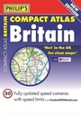
Philip's Compact Atlas Britain 2012
Flexi A5
Philip's (Publisher)
Published on 4. July 2011
Book
Hardback
352 pages
978-1-84907-158-1 (ISBN)
Description
The 287 pages of main road maps in Philip's Compact Atlas Britain 2012 are at the large scale of 3.3 miles to 1 inch (Scottish Islands at 6.7 miles to 1 inch), and include speed-camera locations. The maps clearly mark service areas, roundabouts and multi-level junctions, and in rural areas distinguish between roads above and below 4 metres wide - a boon for drivers of wide vehicles.For leisure users, scenic routes are highlighted, and the maps show upland and highland areas as well as National and Forest Parks, and Areas of Outstanding Natural Beauty. Long-distance footpaths, viewpoints, beaches, golf courses, campsites and caravan sites are clearly shown.
More details
Language
English
Place of publication
London
United Kingdom
Publishing group
Octopus Publishing Group
Dimensions
Height: 218 mm
Width: 152 mm
Thickness: 18 mm
Weight
542 gr
ISBN-13
978-1-84907-158-1 (9781849071581)
Copyright in bibliographic data and cover images is held by Nielsen Book Services Limited or by the publishers or by their respective licensors: all rights reserved.
Schweitzer Classification
Other editions
New editions
Book
09/2013
Philip's
€32.39
Article is exhausted; no reprint
Previous edition

Book
06/2009
Philip's
€32.39
Article exhausted; check for reprint