

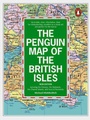
The Penguin Map of the British Isles
Including the Orkneys, the Shetlands, the Channel Islands, And Also Much of Normandy
Penguin Books Ltd (Publisher)
Published on 26. April 1984
Book
Paperback/Softback
978-0-14-051140-6 (ISBN)
Description
A wall-map covering the British Isles and Normandy. All the new motorways and access points are marked, and the map includes the Orkneys, Shetlands and the Channel Islands.
More details
Language
English
Place of publication
London
United Kingdom
Illustrations
col
Dimensions
Height: 215 mm
Width: 158 mm
Thickness: 10 mm
Weight
122 gr
ISBN-13
978-0-14-051140-6 (9780140511406)
Copyright in bibliographic data is held by Nielsen Book Services Limited or its licensors: all rights reserved.
Schweitzer Classification
Other editions
New editions
Michael Middleditch
The Penguin Map of the British Isles
Including the Orkneys, the Shetlands, the Channel Isles and Most of Normandy
Book
08/1998
2nd Edition
Penguin Books Ltd
€27.42
Article is exhausted; no reprint