

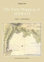
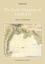
Early Mapping Of Hawaii
1st Edition
Published on 4. January 1987
Book
Hardback
164 pages
978-0-7103-0240-3 (ISBN)
Description
First published in 1987. The cartographic history of Hawaii began with the arrival of explorer and chartmaker Captain James Cook in 1778. Between then and the mid-19th century, visitors to Hawaii produced a rich assortment of charts amid maps depicting the shores, harbors, towns, and volcanoes of the various islands. This volume traces the story of the mapping of Hawaii during the pivotal years in which the indigenous society was radically transformed by the peoples and ideas imported from the West. A major segment of The Early Mapping of Hawaii it examines the contribution of American missionaries in mapping Hawaii. Mostly produced at the seminary school at Lahainaluna, Maui, these maps introduced geographical education into the Hawaiian school system. Lahainaluna graduate S. P. Kalama produced a landmark map of the islands in 1838, one of the most significant maps in Hawaiian history. Nearly one hundred maps, views, portraits, and illustrations are reproduced here. Included are many charts and harbor plans produced by James Cook, William Bligh, George Vancouver, Otto von Kotzebue, Urey Lisiansky, Jean Francois de la Perouse, Louis Duperrey, and Charles Wilkes. These charts document the early geography of Honolulu, Lahaina, Hilo, and Kailua, as well as many bays and harbors in the islands.
More details
Language
English
Place of publication
London
United Kingdom
Target group
Professional and scholarly
Dimensions
Height: 358 mm
Width: 250 mm
Weight
1640 gr
ISBN-13
978-0-7103-0240-3 (9780710302403)
Copyright in bibliographic data and cover images is held by Nielsen Book Services Limited or by the publishers or by their respective licensors: all rights reserved.
Schweitzer Classification
Other editions
Additional editions
Fitzpatrick
Early Mapping Of Hawaii
Book
06/2020
1st Edition
Routledge
€57.13
Article exhausted; check different version
Gary L. Fitzpatrick
Early Mapping Of Hawaii
E-Book
03/2020
1st Edition
Routledge
€60.49
Available for download

Gary L. Fitzpatrick
Early Mapping Of Hawaii
E-Book
03/2020
1st Edition
Routledge
€60.49
Available for download
Person
Gary L. Fitzpatrick
Content
Preface; Acknowledgments; Chapter 1 Captain James Cook and the First Map of Hawai'i; Chapter 2 The Explorers; Chapter 3 Harbor Charts; Chapter 4 Mapping Hawaiian Volcanoes; Chapters Missionaries and Maps; Chapter 6 Hawai'i in the World; Chapter 7 Hawai'i Nei; Notes; Citations of Illustrations; Bibliography; Index.